
Topographic Surveying a Steep Lot Before Selecting the Building Pad
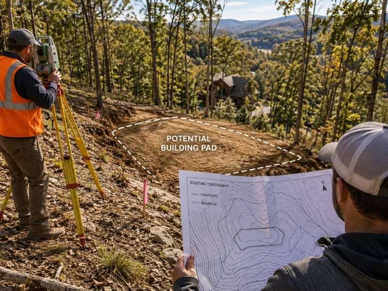
Steep lots rarely offer one clear spot to build. The land often hides flatter pockets between sections of much sharper slope. Finding those pockets takes more than a quick walk around the yard. A topographic survey brings that hidden shape into view. It gives homeowners and designers real numbers to base a choice on.
Picking a building pad without this data is a gamble. A spot that looks fine from the driveway might sit right above a drainage path. Another spot only a short walk away might need far less grading. Measured land data turns that guesswork into a real decision.
Showing the Natural Benches and Breaks in the Terrain
Every steep lot has some change built into its overall slope. Contour lines show that change clearly. Some parts rise steady, while other parts flatten out for a bit before dropping again. These flat spots, called benches, often make far better building sites than the slope around them.
Spotting a bench just by walking the ground can be hard, especially on a lot with brush or trees. A detailed contour map removes that guesswork. It lets a designer compare a few pad spots side by side and pick the one that needs the least digging.
Charting Runoff Above and Below the Proposed Pad
A flat spot on a hillside is not always a safe place to build. Water moving down from higher ground can cross right through that spot during a storm. Grading around a new pad can just as easily push water toward a neighbor’s yard below.
Mapping this runoff path before building starts gives the team a chance to plan around it. Knowing where water naturally travels, both above and below a pad site, helps avoid a house that ends up sitting in the path of water it was never built to handle.
Mapping Existing Cuts, Fills, and Retaining Walls
Many hillside lots have already been changed in some way. This could be an old driveway cut, an old wall, or fill dirt placed years ago to level part of a yard. These past changes need to be marked, since they can act differently than plain, natural soil.
A spot built up with old fill dirt may not hold weight the same way solid, packed soil does. A wall of unknown age deserves a closer look before new work goes in nearby. Marking these features gives engineers a reason to check further, instead of assuming the ground is the same everywhere.
Calculating the Vertical Relationship to Road Access
A building pad does not stand alone. Its height compared to the street shapes the driveway grade. A driveway that is too steep can cause real problems, from trouble with cars in bad weather to simple day to day use.
Working out this height match early helps a designer pick a pad spot that will not force a driveway that is too steep. In some cases, a slightly less perfect pad spot ends up being the smarter choice once driveway grade gets factored in.
Giving Engineers the Existing Surface for Pad Design
All of this measured data feeds into one existing conditions model. Engineers use this model to design the actual grading and structure plan for the pad. Cut and fill amounts, wall needs, and foundation plans all depend on a real starting surface.
A pad design built on guesses tends to hit surprises once digging starts. Starting with real land data cuts that risk down a lot. It gives the engineer a true picture of what the site actually needs before building gets underway.
Frequently Asked Questions
Can the surveyor certify that a location is the safest option?
The surveyor maps the land. Engineers and other experts judge whether a design is safe and fits well for that spot.
Will the survey estimate excavation quantities?
Survey data can support these numbers, but the real quantity numbers depend on the grading plan the design team creates.
Should the driveway route be surveyed at the same time?
Yes, when access design is part of the full project review. Driveway grade often shapes where the best pad spot really is.